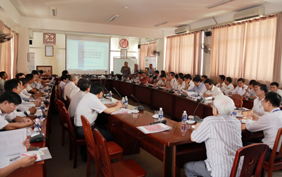
On December 14th, 2015, the DTU Faculty of Civil Engineering teamed up with the Danang Association of Surveying, Cartography, and Remote Sensing to hold a seminar entitled “New Technologies in Surveying and Cartography”. Mr. Duong Binh An, head of the association, government agencies, construction businesses and DTU Faculty of Civil Engineering lecturers attended.
Professor Vu Xuan Quang speaks
“Recently, Duy Tan University has been focused on the development of research,” said DTU Vice-Provost, Professor Vu Xuan Quang. “Our investment in the Institute of Research and Development is part of this. In the field of Construction, the Institute’s Center of Construction Science and Technology has assembled a group of young PhDs and Masters, who have all published papers internationally, to contribute to the improvement of education and research here. DTU has also signed an agreement with California State University (CSU) Fullerton and with Cal Poly San Luis Obispo to develop the first advanced programs in Architecture and Civil Engineering in Vietnam, which offer students the best opportunities for study and practical work. Our discussions at today’s seminar will provide new ideas and plans for further collaboration with local government and businesses, in training a professional workforce in Civil Engineering and Surveying in Danang.”
Lecturers of the Faculty of Civil Engineering with attendees
Mr. Duong Binh An presented a talk on “Automation In Digital Cartography Surveying: the Theory and Practical Applications”, about technology used in construction research and planning, allowing optimum use of state-of the-art software and modern surveying equipment. This saves time in recording and drawing maps, improves the efficiency and accuracy of map-drawing, and so on. The DTU Faculty of Civil Engineering has started to apply this software, especially in the disciplines of Surveying and Surveying Practice.
Representatives of the Saigon Instrumentation Company and SGMC Vietnam Ltd. Demonstrated some new equipment and technology solutions they currently use in surveying and cartography, and in 2D and 3D model reconstruction, such as the Aibotix X6 UAV, laser scanners, and Flycam.
(Media Center)